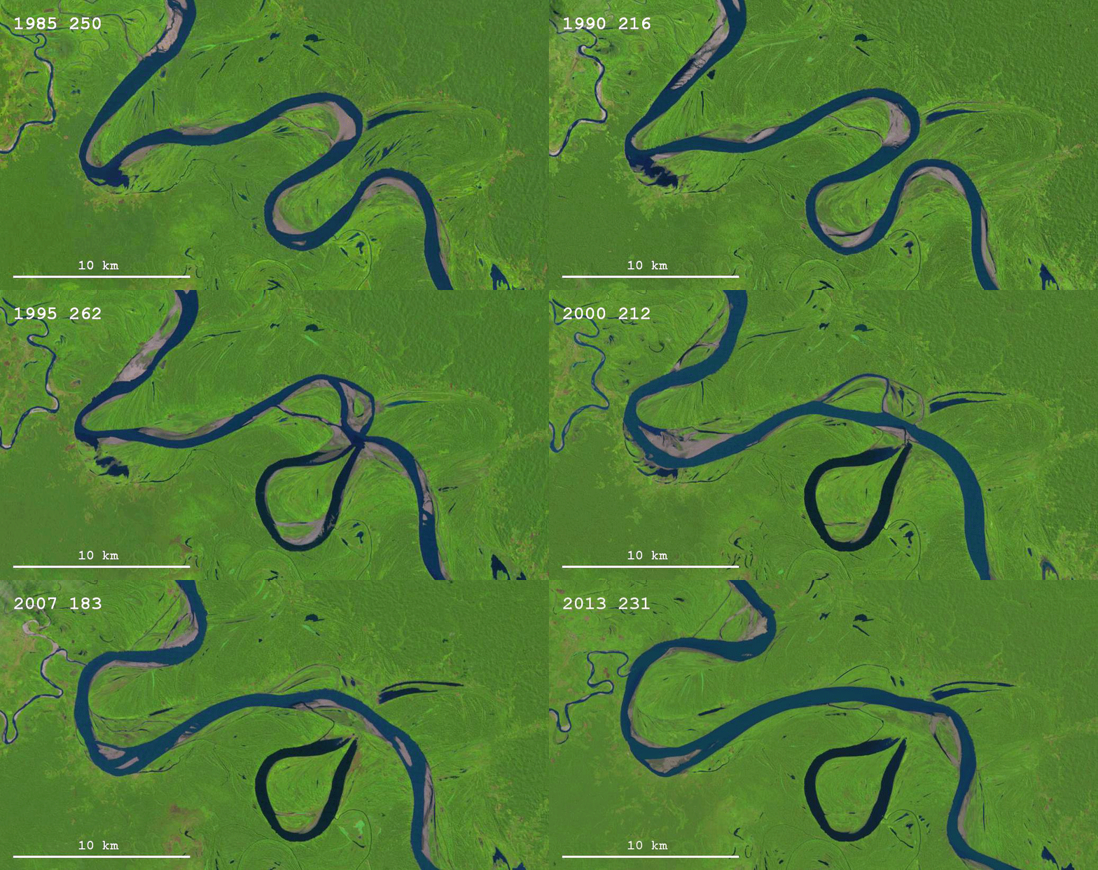
Thanks to the Landsat program and Google Earth Engine, it is possible now to explore how the surface of the Earth has been changing through the last thirty years or so. Besides the obvious issues of interest, like changes in vegetation, the spread of cities, and the melting of glaciers, it is also possible to look at how rivers change their courses through time. You have probably already seen the images of the migrating Ucayali River in Peru, for example here. This river is changing its course with an impressive speed; many – probably most – other rivers don’t show much obvious change during the same 30-year period. What determines the meander migration rate of rivers is an interesting question in fluvial geomorphology.
The data that underlies Google Earth Engine is not accessible to everybody [update: it is accessible if you have a GEE account], but the Landsat data is available to anyone who creates a free account with Earth Explorer. It is not that difficult (but fairly time consuming) to download a set of images and create animations like this (click for higher resolution):

This scene also comes from the Ucayali River (you can view it in Google Earth Engine over here) and it is a nice example of how both neck cutoffs and chute cutoffs form. First a neck cutoff takes place that affects the tight bend in the right side of the image; this is followed by a chute cutoff immediately downstream of the neck cutoff location, as the new course of the river happens to align well with a pre-existing chute channel. The third bend in the upper left corner shows some well-developed counter-point-bar deposits. There is one frame in the movie for each year from 1985 to 2013, with a few years missing (due to low quality of the data).
Update (04/14/2016): If you want to use the animation, feel free to do so, as long as you (1) give credit to NASA/USGS Landsat, (2) give credit to me (= Zoltan Sylvester, geologist), and (3) link to this page.